
Big Bend, Terlingua and Surrounds
- dannymontague
- Nov 6, 2025
- 9 min read
Updated: Nov 11, 2025
With the summer heat now past and the air feeling crisp, Big Bend was calling. If you've been there or studied the area, you know that generally November through March is the best time to visit. Summers are not recommended due to the heat extremes. Since winter nights in the desert can get frosty for camping, I chose to make the journey in early November. And indeed the timing was perfect. Sunny skies were solid across on the weekly forecast. Side note: in February 2021, I came super close to making this trip on my old Harley, but the major winter storm hit Texas. While the impact wasn't huge on Big Bend, I ultimately decided to divert Key West that year instead to not risk any impacts for traveling through Texas. Perhaps that has also influenced my November timing. Last spring I spent some time in Austin, and was tempted to make the trip further south then, but this is a journey best done with adequate preparation. - and with adequate gear. That's especially the case if you want to camp in and hike the remote backcountry and maintain contact via satellite connection with the world.
There a few decent routes down to this area, but I knew I wanted to check out Lajitas and Terlingua, and was coming from the east. On the way back north I could pass through Marathon. So, I selected San Angelo as my final night stop prior to making the journey down into the region. This led me through Ft. Stockton followed by Alpine, then onto Terlingua by nightfall. As I made it into Terlingua, it was evening and the place was lit up like Christmas - a sort of Southwestern fiesta lighting or so called trailhead twinkle common as part of the van-life movement, reminiscent of desert glamping style. In short, if you want to know what all this is about, the one place in the US you have to go to see it is Terlingua, Texas (in the evening).

Before Terlingua though, Alpine was a great place to pick up some last minute supplies. I've increasingly learned in my travels to familiarize myself with availabilities of certain items in certain areas and to only stock those items as needed - basically a lean approach to travel. For example, I didn't bother with propane fuel tanks until I got to San Angelo. Having done some cross country adventure motorcycling before, I've learned this.
My advice is lean more toward getting what you need only when you need it, perhaps plus one stop back. In other words, if I read online that Terlingua has 1lb propane tanks, I'm getting them one stop prior to Terlingua. So yeah, not waiting until the last stop, but it sort of depends on what it is, how much space it consume, criticality to safety (always carry extra water, for example), packaging waste impact, etc. Although I have the room to haul all the gear I need with the Power Wagon, I still like to keep things as orderly as possible - makes the trip more enjoyable.
While places like the Cottonwood General Store in Terlingua or the Lajitas General Store in Lajitas have a nice assortment of essentials (they tend to know well what visitors need), I mostly had everything I needed for the backcountry camping by the time I made it past Ft. Stockton - for safety sake. You just never know when a small town store is closed for some unknown reason, out of stock, or whatever. On the flip side, consider that Texas is huge and there's no need to lug everything you need all across the country - if driving from afar. If you wouldn't do that with ice in the cooler, you might consider a similar approach with other items as well. There's even an Academy Sports store in San Angelo, but of course this is about 300 miles away. So, when going to Big Bend, San Angelo is a good last stop for major gear.


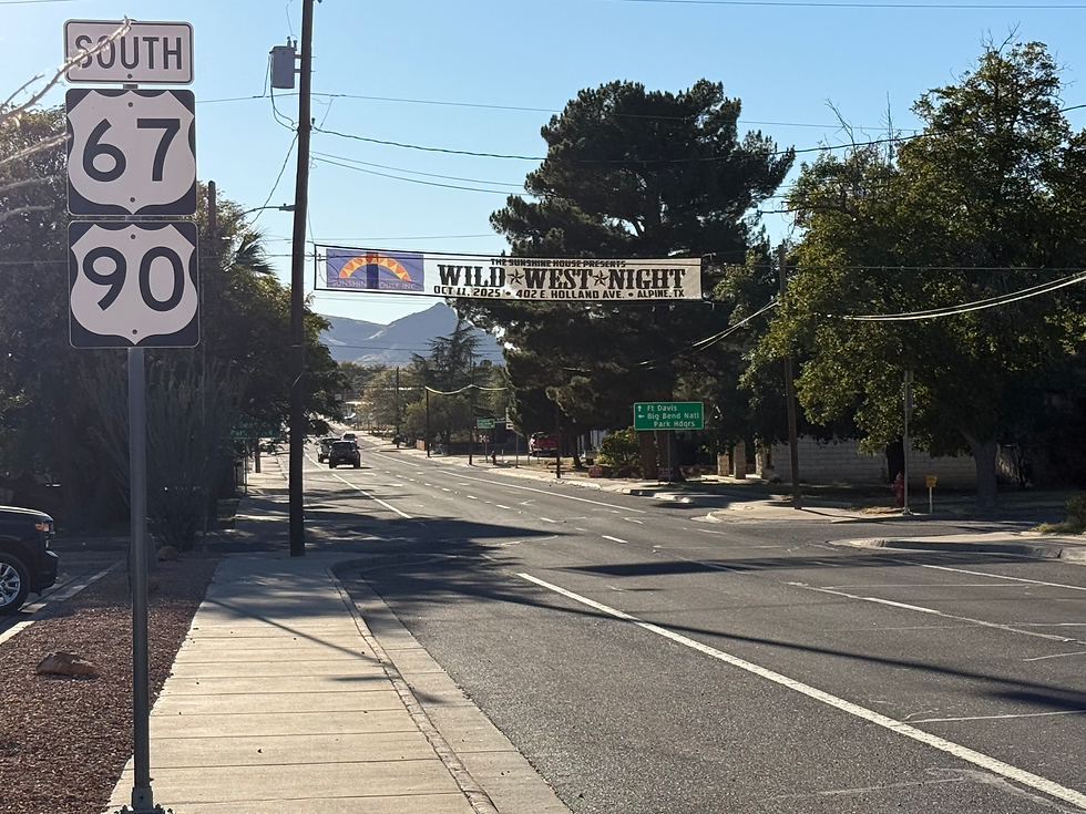
If making this trip, think about anything additional you may need on the way through Alpine - especially vehicle parts related. The next stretch (80 mi) is very rural. They have an Autozone in town if you need anything for the vehicle - and this would be the stop to verify you're all good there.


My packing list was fairly thorough and I pretty much had everything needed when rolling into town. An exception to this, however - the one critical item, the lack of which could have yielded devastating consequences: good fresh ground coffee.
Fortunately my fears were resolved when the Lajitas General Store had some of the best smelling coffee I'd had in days. I selected the TEXSpresso and it didn't disappoint.


The Lajitas General Store also made literally the best turkey and bacon sandwich I think I've ever had. It's one of those set-ups where you just fill out a little sheet and customize your ingredients. Maybe I was just hungry, or maybe it was just as good as I remember it, or perhaps a combo of the two.

Lajitas is over in the vicinity of Big bend State Park (different than and west of the NP). Covering over 300,000 acres, it almost half the size of the National Park (NP) so one can spend some serious time in there. On this trip, most of my time was in the NP.

For my golfer friends reading this, you may want to check out Lajitas - a huge private golf resort. You can pretty much see the green from space. Looks a like a cool place and is a destination I'd been thinking about getting to for years (but I don't golf). Since this was a solo journey, I decided to stick to camping combined with a couple of nights of unique Airbnb. For that, I selected a little place called the Bus Stop which was totally awesome for the first couple of nights - allowed me to get my bearings before camping out in the wilderness.


This place has got those late 80s / early 90s vibes, with a cool view I might add; the kind of place reminiscent of every good movie where the characters venture west (like to Vegas) on a whim and find themselves deliberating some life altering decision, like whether they should look into what those strange lights are in the sky or whether they should prank a trucker. I digress, but you get the point. And yeah - the bus and the car are much older than 80s models.

If traveling by way of time machine, there's a payphone for you to call a cab and a good jukebox for you to listen to some classic 80s hits while you wait. Warning: it may be a while though, cause this place is out there quite a ways. It feels that way at least when you're there.
On the other hand, as remote as this place may feel, it's actually not far from the Lajitas Airport. This isn't the bustling kind of airport you'd usually expect, but rather the kind where the occasional chartered jet lands - mainly for those visiting the nearby Lajitas resort. So, if you want to see this area without making the long drive, it may be worth checking that out on their website. You'll easily find it by Google. I'm not linking to it here cause this isn't really isn't some sort of ad, but it is ultra unique and noteworthy when taking about the area. That airport sort of reminds me of the Canyonlands airport in Utah near Moab. Basically, it's a way to get from larger airports to the destination and skip the long haul (if that's your kind of thing). As for me, I'm more of an its the journey and not the destination kind of guy. So, the road it is.

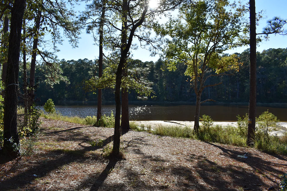
The "Bus Stop" (Airbnb) was between Terlingua and Lajitas. After passing back through Terlingua and making one final stop attempt at Cottonwood General store for ice, I was ready for the adventure into the wild.


Important note: not all of these pictures are exactly in order based on the route I took.
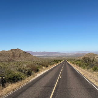
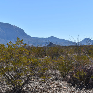
Big Bend National Park is larger than the state of Rhode Island. It bounds the Rio Grande, and features some of the most geographically diverse landscape you'll see. Having been to many other NPs before, I can truly say this place continued to surprise at every corner. It even had the feel of Zion NP in the Chisos Basin region (not quite the same scale, but surprisingly similar).


The gallery here shows my camp set-up and the exploration. I had a back-country permit I applied for prior to the gov't shutdown for Pine Canyon - so I was able to set up camp in an epic location - near Pine Canyon and Emory Peak, just a few clicks north of the Rio Grande.


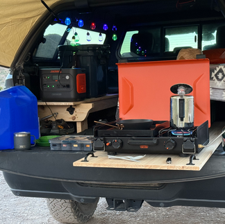


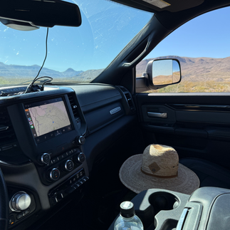


I included a couple of pics of my Starlink Mini receiver set-up which has been fantastic on this journey. The built in wi-fi router performance was impressive - reaching over 400 feet away (distance checked with Garmin Forerunner). This was perfect at the remote campsite. I also carried the Garmin Mini InReach with me, but only planned to carry it with me on hikes going through narrow canyons and unknown territory. My iPhone 16 has SOS capabilities but the sat network isn't quite as extensive as the Iridium network. For anyone doing serious off grid adventure, I suggest having at least one of the these three means available: 1. Starlink on connected to mobile device when exploring in vicinty of camp, 2. Garmin InReach (or Garmin Montana 700 series) and 3. iPhone 14 or above (SOS for off-grid with limitations). Beware of so-called "anywhere" 2-way messengers that piggyback on existing cell networks. The key with those is that they do not use satellites and could be worthless in truly remote settings. I expect to do a separate blog post on the specifics, including how to attach said devices to the vehicle and yourself when out and about.
I've written about the camp power set-up in a prior post, but in brief, I use the Jackery Explorer 1000 which is perfect for a set-up of this size. Portable and sufficient (1000 w) for my power needs with the camper top set-up. The main power draw is Starlink if not running heat. Second to that is recharging devices and powering lights. It lasts a full day if there's no substantial heat use.
The moon was waxing gibbous, so while this is a dark sky region not all constellations were as visible as they could otherwise be - but the moon itself was pretty awesome.
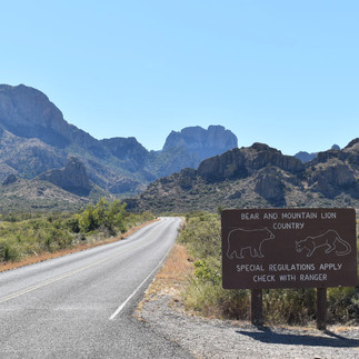
Bear, mountain lion and coyote are prevalent in this general area, but I didn't encounter any during this trip. I wasn't seeking them out because I prefer to minimize disruption of their habitats. Food storage and encounter safety is beyond the scope of this blog post, but obviously, if you're going out to a place like this, it's essential to refreshen your plan and read up on best practices. My philosophy is simple - go prepared for the worst, but be respectful of their habitat. I care greatly about the animals and want them to be able to carry on as safely as they can.

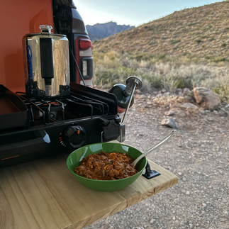
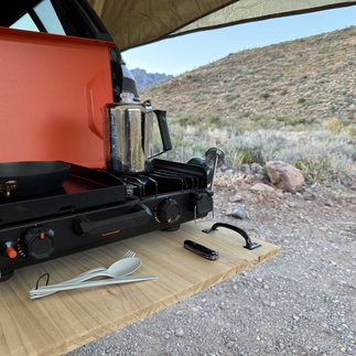
Below: Boiling water using the percolator. It was also used for brewing coffee, of course. Makes some awesome brews!


If traveling through this park a stop by the visitor center at Panther Junction is highly recommended. While the Visitor Center at Chisos Basin wasn't open (due to Gov't shutdown) this one was, and they have a ton of stock. I should note, the general food store at Chisos Basin was open and the dude working the counter was very helpful with info. I picked up a few interesting books at Panther Junction. While they can be bought online, it's just cooler remembering they came from the park itself and I like supporting the NP, especially during this time.

There is also an Alon fuel station in Panther Junction and they sell food and have picnic tables - great little lunch stop. Now's probably a good time to mention there's also one Alon fuel station in Terlingua. So, gas stops have to planned meticulously. For me, I also am big on reducing idle time for the truck (a high idle to drive ratio is not great for Hemi engines), but that also helps me save fuel. So, the mobile power bank helps with this - I don't rely on idle to power anything.

On the journey back north through Marathon, TX (en route to New Mexico via Pecos TX) I stopped at a couple fo the historical sites. Los Caballos is especially interesting from a geological standpoint - folds in the earth lifting up from more than 250 million years ago.


From there as proceeding to the northwest toward Carlsbad, NM, I ran through the heart of the Permian Basin - oil country. And it is busy - very busy. When I travel solo, I tend to strike up conversations with people from the areas I visit and catch tidbits of details in the process. It's amazing to see and hear about the expanse of the oil fields and production activities in this area. I made my way up to Pecos, TX and then to Carlsbad, NM with a planned stop in Roswell.
Check out my next post about the visit to Roswell, NM!


Comments