
The Wild Expanse Below Carmel
- dannymontague
- Oct 29, 2025
- 3 min read
Updated: Nov 3, 2025

Big Sur as it's now known, once known as el sur grande (the big country of the south) when Cali was Mexican territory, is that wild expanse accommodating the PCH (Pacific Coast Highway) south of Carmel. This is a place where the crashing waves had sent some low resonance frequency to my brain - calling me to visit. Having spent time in the area to the north (Half Moon Bay, San Fran, etc.) in years prior, I was aware of this place from subtle references, including, the kick ass song, "Big Sur" by Porcelain Raft. And yeah, had to play that while driving the PCH on this trip.
To say this place didn't disappoint would be the understatement of at least a decade. There are (rare) times when I'm traveling that I go into to this sort of I can't get lost here mode. And while I did well on the US Army land nav test, I'm not talking about that kind of lost. In other words, I could be lost as f&%* in this place by tangible measures, but perfectly where I'm supposed to be. If you know, you know.

Using Carmel-by-the-Sea as a quasi base camp, I threw my gear in the vehicle and headed out for what the practical side of me said was a day trip, but the back of mind said "better take enough for a a day or two, or three."

Bixby Bridge is a fun place to photograph, especially at Sunset. I had may my way to a great spot to capture the bridge and sunset in one shot and a couple came over to the same spot to fly their drone. It flew over the bridge and over the coastline. We did the whole "I'll take your pic, will you take mine thing." I mean, why not? there's only this little old bridge and half a sun in the background.

I'd been reading about the road being out at Lucia, which is basically at the bottom of the Big Sur region, so coming in form the North was necessary. Practically this meant, one way in and one way out (there may be a true backcountry exception but I looked and didn't see it). It's like a temporary dead end coastal highway due to the landslide damage.

There are hundreds of miles of hiking trails in this place, mostly in the California State parks. If you're heading that way, know that one pass for the day purchased at some one location works for all state park locations that day (don't hold me to that as there's alway some kind of exception lol).
I'm at the point on this one where I should just let the pictures do most of the talking. So...


I snapped this picture standing in the middle of the stream on a trail down to the beach.


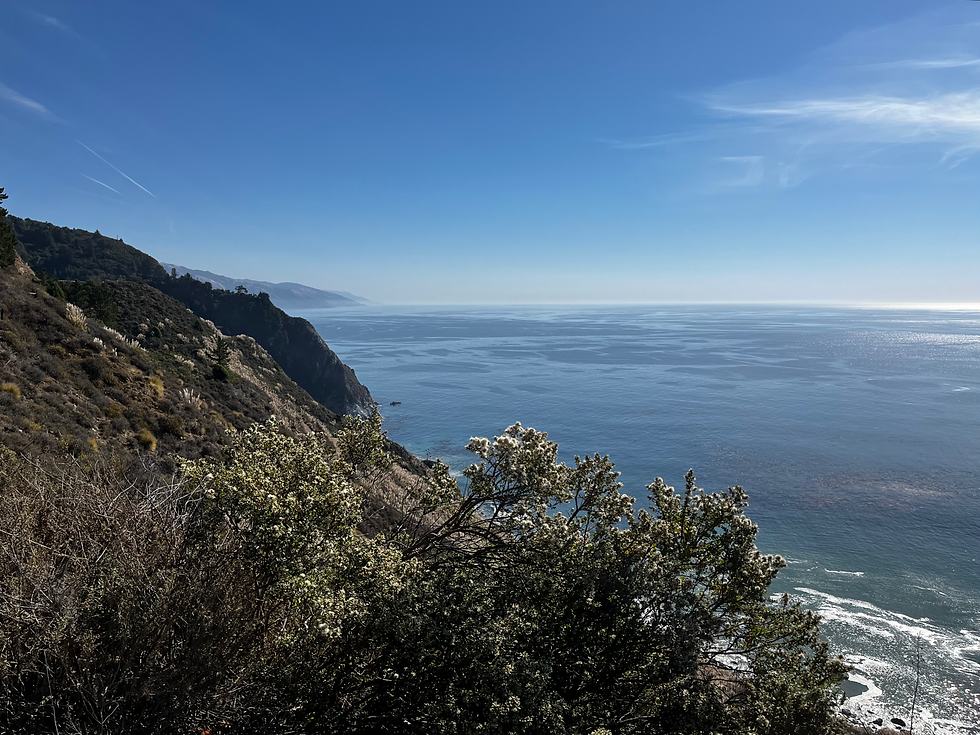
Ridge trail and Bluff Trail, like many in the area, let you walk right along the edges of the bluffs towering the coastline. Of course, it is wise to stay back from the edges, not just for safety, but to help preserve to edges of the bluffs.
The leave no trace aspect is especially important out here. Let's keep this place amazing.

No bridge? No problem. Just may want to call carry your shoes as you wade to cross the stream.


McWay Falls at Julia Pfeiffer Burns State Park (above and below at different zooms). I encourage anyone interested in exploring the area to read up on Julia Pfeiffer Burns, her history and contributions in the area.


Big Sur Lodge is a great place to grab a bite if you don't want to pack in meals (I always take trail snacks) and you don't want to track back too far toward Carmel/Monterrey.


All photos this page © 2025 Danny Montague
See photo usage terms page for details on using these images.


Comments